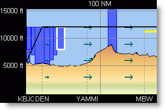
The Profile View shows airspace along the planned flight path. This airspace is shown if the planned flight path travels through, over, or under the adjacent airspace. The airspace is shaded in the following colors:
Blue areas are associated with Terminal Airspace (in the U.S., for example, around Class B and C airports).
Purple areas show Class E.
Red areas depict Special Use Airspace ( SUAs) such as restricted, MOA, and alert areas.
Yellow areas represent Temporary Flight Restrictions (TFR's),
To view the properties of the airspace shown on the Profile View:
Double-click the border or edge of the airspace. The border highlights in white as displayed below.
Click Close when finished viewing the airspace properties.
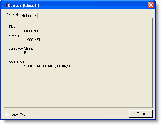
When airspaces overlap in the Profile View, a selection dialog appears when you double-click the area. Select from the list and click Info to display the airspace properties.