Crossing or hard altitude is a specific altitude associated with a waypoint, usually in procedure descents, that you want the program to incorporate in the route. For example, if ATC instructs you to cross a waypoint at a certain altitude, you would set a hard altitude at that waypoint.
Use either of the following methods to set hard altitudes:
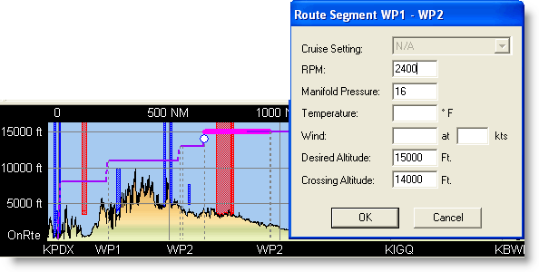
Right-click a leg in the Profile View and choose Properties from the shortcut menu. In the Crossing Altitude field, of the Route Segment dialog box, enter the altitude required at the first waypoint of the selected leg.
Open the Route Calculator and find the waypoint following the one where you want the hard altitude to start. Click the field in the Desired Leg Altitude column. In the Crossing Altitude field, of the Route Segment dialog box, enter the altitude required at the first waypoint of the selected leg.
Hard altitudes are displayed in the Profile View as white dots at waypoints when the waypoint is visible, or as white dots at the edge of the window when the waypoint is out of view.