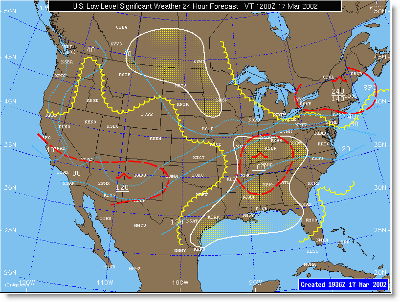
Flight Conditions — Regions expected to experience IFR conditions at the valid time of the map are depicted with yellow shading. Regions expected to experience MFVR conditions at the valid time of the map are depicted with yellow scalloped lines.
Turbulence — Areas of turbulence are depicted by red dashed lines. Areas are labeled with the intensity of turbulence expected using the standard red turbulence symbology (moderate or severe) and with the altitude range in white (hundreds of feet). If only one number appears for the range, it is implied that the turbulence exists from the surface up to that flight level.
Freezing Levels — Freezing level contours are depicted with light blue dashed lines at 4000 foot intervals and labeled in hundreds of feet. The surface freezing line is a light blue, dotted line and is labeled "SFC".
Maps are valid for 12- and 24-hour forecast periods and are updated four times per day, valid at 0000, 0600, 1200 or 1800 UTC. Maps are available at 0045, 0645, 1245 and 1845 UTC.
See Jeppesen WX Low Level Map Symbols for a key to the symbols used in the low-level maps.
