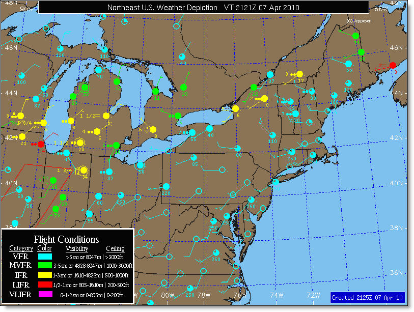

Flight Conditions — Color of station as well as labeled directly to the right of station circle.
VFR (light blue) — visibility greater than 5 miles and ceiling greater than 3000 ft.
MVFR (green) — visibility between 3 and 5 miles and/or ceiling between 1000 and 3000 ft.
IFR (yellow) — visibility less than 3 miles and/or ceiling less than 1000 ft.
LIFR (red) — visibility less than or equal to 1 mile and/or ceiling less than or equal to 500 ft.
BCAT1 (purple) — ceiling less than or equal to 200 ft.
Ceiling — Number directly below station circle in hundreds of feet if a ceiling is present.
Visibility — Number to the left of station circle. Value is in units normally reported in METAR for that region. North America reports visibility in statute miles, most other international areas report visibility in meters. If visibility is greater than or equal to 6 sm or 10,000 meters, it is omitted from the map.
Present Weather — Weather symbol is directly to the left of station circle if station is reporting weather.
Wind Direction & Speed — Wind flag used to indicate wind direction and speed. Speed value is in same units as reported in METAR. Most observations use knots, some countries (Russia and China) use meters per second.
Maps are updated once per hour, generally available near the top of each hour and contain the most recent observations from the stations on the map. Valid Time on the map represents the earliest observation time used on the map.

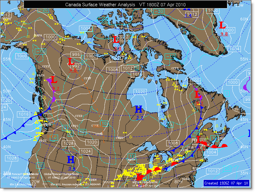
Surface Fronts — Cold fronts are dark blue, warm fronts are red, occluded fronts are purple, stationary fronts are alternating red and blue. Surface troughs are dashed brown lines.
Isobars — Solid yellow lines representing contours of sea-level pressure. Drawn at either 4 or 8 mb intervals and labeled with the last two digits of the pressure (08 = 1008 mb and 96 = 996 mb).
Pressure Centers — Blue H denotes center of high sea-level pressure, and red L denotes center of Low sea-level pressure. Value of central pressure is labeled beneath the center with the last two digits (same as for isobars).
Tropical Systems — The current position of all tropical systems is depicted on the map using standard symbols. A red “L” denotes a Tropical Depression (wind speed less than 35 kts), a red tropical symbol with a hole in the middle denotes a Tropical Storm (wind speed between 35 and 64 kts), and a solid filled symbol denotes a hurricane/typhoon/tropical cyclone (wind speed greater than 64 kts).
Station Observations — white circles and text represent the actual METAR observation data.
Cloud Cover — Shading of station circle. Open = CLR, ¼ shaded = SCT, ¾ shaded = BKN, Solid shaded = OVC.
Temperature — upper left of circle in degrees Celsius
Dew Point — lower left of circle in degrees Celsius
Sea-Level Pressure — upper right of circle using 3 digit notation (123 = 1012.3 mb / 987 = 998.7 mb)
Present Weather — Center left of circle using standard weather symbology.
Wind Direction & Speed — Wind flag denotes direction and speed. Value in METAR units.
Radar Base Reflectivity — U.S. maps only. Contains latest NEXRAD base reflectivity overlay.
Surface Analysis maps are drawn by Jeppesen meteorologists who analyze the latest METAR observations in conjunction with radar and satellite imagery.
Maps are valid at time of the observations, and are prepared for valid times of 0000, 0600, 1200 and 1800 UTC. Maps are available between 1½ hours and 2½ after valid time.

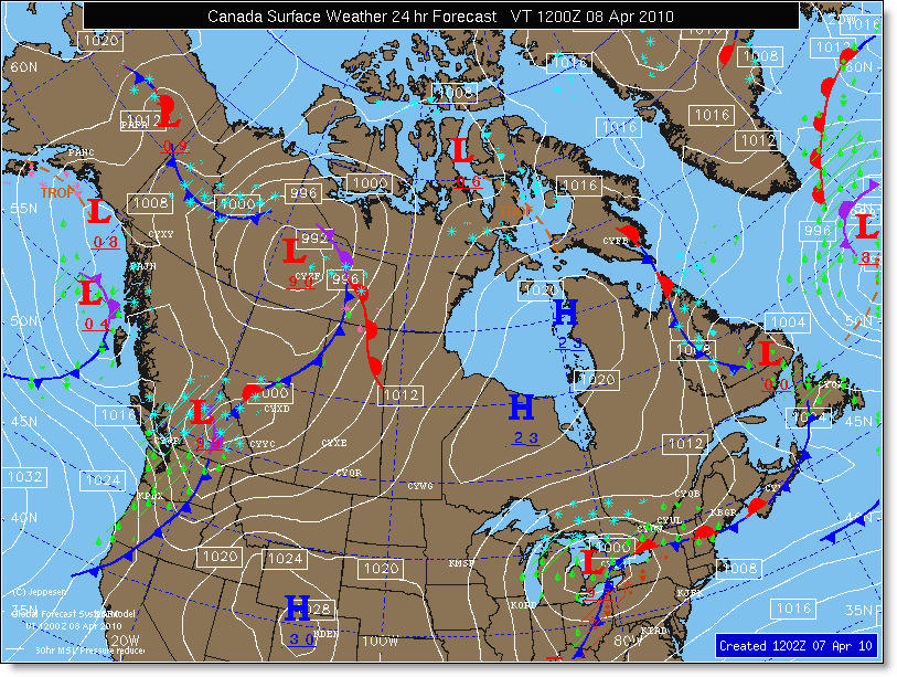
Surface Fronts — Cold fronts are dark blue, warm fronts are red, occluded fronts are purple, stationary fronts are alternating red and blue. Surface Troughs are dashed brown lines.
Isobars — Solid yellow lines representing contours of sea-level pressure. Drawn at 8 mb intervals and labeled with the last two digits of the pressure (08 = 1008 mb and 96 = 996 mb).
Pressure Centers — Blue H denotes center of high sea-level pressure, and red L denotes center of Low sea-level pressure. Value of central pressure is labeled beneath the center with the last two digits (same as for isobars).
Tropical Systems — The current position of all tropical systems is depicted on the map using standard symbols. A red “L” denotes a Tropical Depression (wind speed less than 35 kts), a red tropical symbol with a hole in the middle denotes a Tropical Storm (wind speed between 35 and 64 kts), and a solid filled symbol denotes a hurricane/typhoon/tropical cyclone (wind speed greater than 64 kts).
Precipitation Areas — Areas expected to experience precipitation at the forecast valid time are depicted using solid and dot-dashed lines. Regions where greater than half the area is expected to experience precipitation are shaded. Unshaded regions represent areas where less than half the area is expected to experience precipitation. Solid lines enclose areas where the majority of precipitation is expected to be continuous. Dot-Dash lines enclose areas where the majority of precipitation is expected to be intermittent.
The type of precipitation expected is either within the area or outside the area with an arrow pointing to the area. Standard precipitation symbols are used to denote the type of precipitation. If more than one symbol is used, the top most symbol represents the primary type of precipitation, and the bottom symbol denotes secondary type of precipitation expected in the area.
Surface Weather Forecast maps depict conditions from the surface to FL240 and are created by Jeppesen meteorologists using numerical forecast guidance and current observations. Maps are created for 24-hour forecast periods for all regions.
Valid times are 0000, 0600, 1200 and 1800 UTC. Maps are updated every 6 hours and are available at 0000, 0600, 1200 and 1800 UTC.