The Enroute Charts View is the default display when you open FliteStar, and displays your route in graphic format as changes are made to it. View airports, waypoints, fixes and other details of the entire route, or specify individual legs. Zoom In on the Enroute Charts View by clicking a point and dragging your cursor so the blue box that appears surrounds the area you want to view. You can also access more functionality within the Enroute Charts view by using the right-click menus.
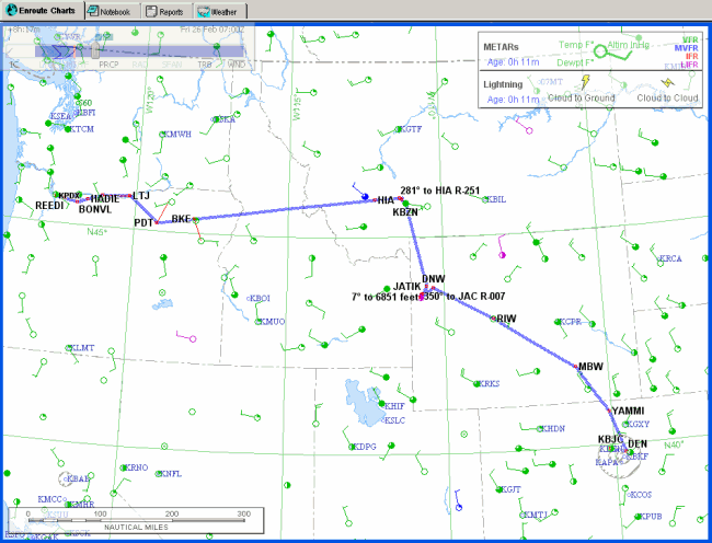
With the information from the tutorial in the system, the Enroute Charts view looks something like this:
The tabs in the view list are:
The Enroute Charts view is the main map screen you view when opening FliteStar. Most flight planning functions take place in the Enroute Charts View.
The Notebook gives you a convenient way to add comments and observations about a route.
Reports are computer generated flight-planning reports. Review, edit and print the results of your flight plan under the Reports tab.
The Weather tab gives you quick access to DUATS weather downloads.
If you also have JeppView installed, additional tabs appear:
Terminal Charts — displays the chosen terminal chart selected from the Airport List or the RoutePack List.
NOTAMS — displays chart NOTAMS for the chosen airport selected from the Airport List or the RoutePack List.
Text — displays the Online Airway Manual and the Bottlang Airfield Manual dependent upon what type of subscription you have (IFR, European VFR or both).
For additional information about JeppView features, see JeppView Features.
You can move easily from one set of functions to another by clicking on the tabs.