This feature is only available when JeppView 3 is installed on the same machine.
When a geographic area filter is set, the Airport List displays only those airports located within that area, enabling you to display and print charts for a particular location. You can filter the Airport List according to a geographic area in three ways, as follows:
From the Geographic Area tab on the Filter Settings dialog box.
By using the current view of the enroute chart to display only the contained airports in the Airport List.
By accessing the Show Approaches Within right-click menu command from any RoutePack, route, airport, or navaid.
In the Filter Settings dialog box, the Geographic Area tab allows you to filter airports displayed in the Airport List according to a specified location.
To view the Geographic Area tab:
Click Filter in the Airport List window and select Airport Filter Settings.
In the Filter Settings dialog box, click the Geographic Area tab.
The Geographic Area tab has many options you can use to filter airports geographically.
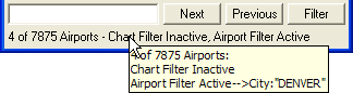
Match any of these locations filters airports according to entered search criteria. Type an airport ICAO identifier (or a portion of the identifier), City, State, or Country in its respective field. After you have entered search criteria, click OK.
FliteStar displays only airports that match the entered search criteria in the Airport List. For example, if you entered "Denver" in the City field, airports located only in Denver appear in the Airport List. The results vary if other filters are applied.
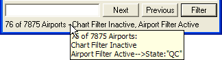
To search for airports within a territory or providence, enter the abbreviation or the name in the State field. For example, to search for airports in Quebec, enter "Quebec" or " QC".
The Are within filter options filters airports according to a selected location. When you set a geographic area filter, a yellow outline appears on the Enroute Charts View within which the airports in the Airport List are located. The default setting is No Geographic Area Filter, but you can use three other filtering setting options:
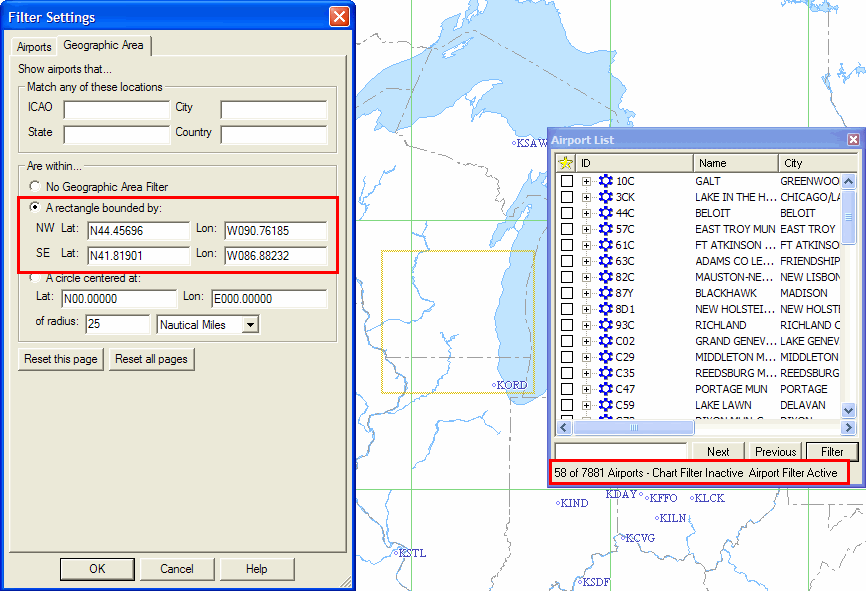
A rectangle bounded by - filters airports within a rectangle. Type the appropriate latitude and longitude points for the northwest and southeast corners. (An easier way to create a rectangular geographic filter is to use the enroute chart. See Filtering Aiports Using the Enroute Chart below).
View an example of a rectangle filter.
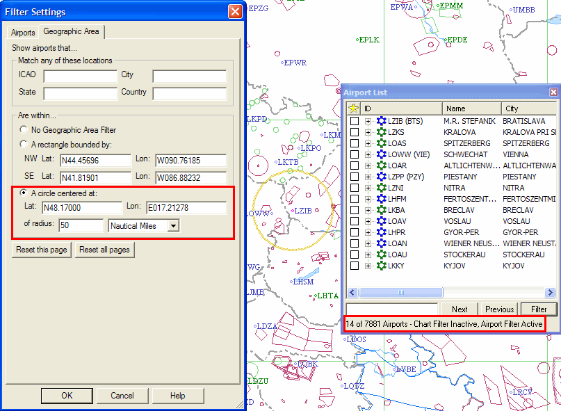
A circle centered at - filters airports around a chart element. Enter the appropriate latitude and longitude center point and the radius distance. You can also select an airport or navaid on the enroute chart to set a circle filter (see Filtering Aiports Using the Enroute Chart below).
View an example of a circle filter.
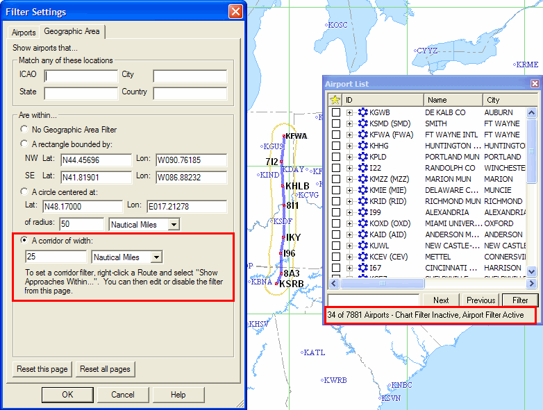
A corridor of width - filters airports around a route. This is active only when a route is displayed in the Enroute Charts View. To initially set the corridor width, do one of the following:
Right-click an airport, navaid or route in the Enroute Charts View and select Show Approaches Within (see Filtering Aiports Using the Enroute Chart below).
Right-click an airport in the Airport List or RoutePack List and select Show Approaches Within.
Right-click a RoutePack or route in the RoutePack List and select Show Approaches Within.
To modify the corridor width, edit the information in the Geographic Area tab of the Filter Settings dialog box.
View an example of a corridor filter.
| TIP | When you apply a route corridor filter, it takes a "snapshot" of the area around the route. If you modify the route, you will need to reapply the filter settings by right-clicking the route and selecting Show Approaches Within. |
All geographic filters apply a yellow border in the Enroute Charts view that depicts the boundary of the filtered area, while the Airport List contains only airports within the selected geographic area.
This is often much easier than trying to type in the values for these filters as described above. You can return to the Filter Settings dialog box if needed to refine the filters you apply graphically.
Zoom and pan the Enroute Charts View to show the area within which you want airports listed in the Airport List.
Right-click an open area on the enroute chart and choose Use View as Geographic Area Filter.
Right-click any airport, navaid, route waypoint, or route on the enroute chart and choose Show Approaches Within.
In the Filter Setup dialog box, enter a distance in the Show Airports Within field, and then click OK.
A yellow boundary on the enroute chart depicts filtered area, and the Airport List contains only airports within the rectangle, circle or corridor. Any other airport filters that you have defined in the Airports tab might effect the results in the Airport List.
Airport filters set on the Geographic Area tab remain in effect until the filters are cleared (or the pages reset). See Removing Filters for information about removing the filter attributes.