This feature is only available when JeppView 3 is installed on the same machine.
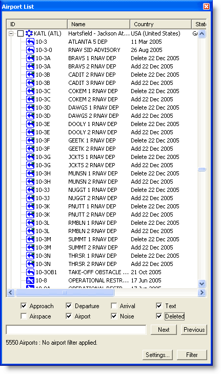
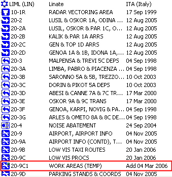
Each airport in the Airport List or RoutePack List has terminal charts associated with it. These charts can include airspace, noise, arrival, airport, departure, and instrument approach charts. Future, obsolete, and temporary charts might also be included in the list. Terminal charts are sorted by number under the airport to which they belong.
To view the list of terminal charts for an airport, do any of the following in the Airport or RoutePack List:
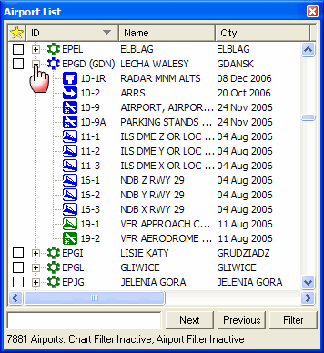
Click the PLUS SIGN (+) to the left of the airport ID.
Double-click an airport.
Select an airport and use the RIGHT ARROW key.
The list expands to include all charts available for that airport. If terminal chart filters are applied (see Terminal Chart Filters), only some of the terminal charts might be listed.
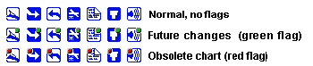
Each terminal chart appears in the Airport List with an icon that depicts its type as shown in the table below. If an IFR airport has VFR charts (Europe only), you can distinguish between the different charts by the color and chart description in the terminal chart list.
IFR Icons
|
|
IFR Airport |
|
Airport — Airport Diagrams, Airport Info, Take-Off Minimums, JAA Minimums, Parking Stands & Information, Parking Coordinates |
|
|
Airspace — Class B Airspace, Radar Minimum Altitudes, IFR Minimum Vector Altitude Clearance, Radar Vectoring Area, Control Area (CTA), Terminal Control Area (TMA), Climb/Descend Areas, Approach Control Area |
|
Arrival |
|
|
Departure |
|
Noise — Noise Abatements, Preferred Runways and Flight Paths |
|
|
Approach — ILS, RNAV, VOR, etc. Runways |
|
Text — Special Notes |
European VFR Icons
|
|
VFR Airport |
|
Airport — VFR Aerodrome Landing Chart |
|
|
Airspace — VFR Area Chart and Information, VFR Visual Reference Points |
|
Text — VFR General Aerodrome Information, VFR Text Day, VFR Text Night, VFR Departure |
|
|
Approach — VFR Approach chart |
|
|
Besides the chart’s type, the icon depicts the effectivity of the chart. When a chart is not current; a green or red dot indicates the chart’s effective status as shown below.
Terminal chart changes are one of two categories:
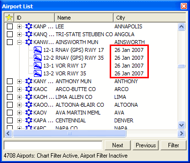
Changes that are effective immediately upon receipt of a CD or an available download — Most chart changes are of this category. When an airport is expanded in the Airport List to reveal its terminal charts, the dates that appear in the City column are revision dates, and should not be confused with an "effective" date.
The terminal charts seen below were downloaded from the Internet on January 26th. The date specified under the City column - 26 Jan 2007 - is the revision date. The charts are effective upon receipt and appropriate to use during flight.
Changes that become effective mid-cycle on a specified date — Jeppesen charts use an effective date if a chart is issued before it can be used. In this situation, you should continue to use the previous chart until the effective date. When an airport is expanded in the Airport List to reveal its terminal charts, you will see the current chart and the future effective chart. The future terminal chart has a green symbol on the icon to represent future effectivity and displays information about when it will become effective.
On the terminal chart heading, you will also see the revision date and the effective date. If there is no effective date, you may use the chart upon receipt.

When you print a Trip Kit before a terminal chart is effective, it includes the current and the future effective chart.
On the effective date at 0901 GMT, FliteStar expires the old chart by marking it obsolete with a red dot, and displays the new chart as the current one. The red dot disappears the next time you update your terminal charts.