The CSC and DTC DUAT/S weather graphics described below are larger than text files and may take longer to download. If you are connected at higher modem speeds or have a direct Internet connection, this does not make as much difference as at slower modem speeds.
The tail number for your selected aircraft must be valid to download DUAT/S weather graphics.
| NOTE | For information about setting up and connecting with DUAT/S, see Setting Up Accounts. |
This section covers the following topics:
To begin the download process:
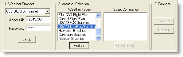
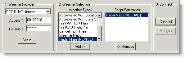
Click the Weather tab and select a provider in the DUATS Controller.
Select one or more items in the Weather Types section.
For details on how to select graphic weather maps from the Jeppesen Weather Service see Jeppesen Weather Graphics. To select CSC and DTC graphics:
Click Add>> to open a list of available graphics.
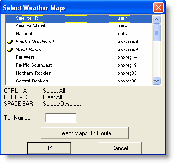
Click to check the graphics you want. To automatically select all the CSC NEXRAD radar maps along your route, choose the Select Maps on Route button at the bottom of the Radar Maps dialog. These maps often have large areas of overlap, and auto selection may save you some download time by ignoring unnecessary maps.
Click Add>> to open a list of available graphics.
Click to check the graphics you want. To automatically select all the CSC NEXRAD radar maps along your route, choose the Select Maps on Route button at the bottom of the Radar Maps dialog. These maps often have large areas of overlap, and auto selection may save you some download time by ignoring unnecessary maps.
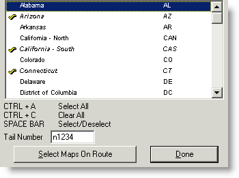
Click Done to post the weather maps script to the Script Commands portion of the window.
After selecting all the items you want, click Connect or Dial.
Graphics appear as thumbnails in the Weather Thumbnails pane on the right side of the Weather tab, below the list of text weather types. Click a thumbnail to display the image in the main viewing area of the Weather tab.

If you downloaded more than one weather image in the same category,
the image names stack upon each other in the thumbnail, with the newest
graphic being displayed to the oldest graphic downloaded. The time stamp
is based on the file date in the DUAT/S server. The time zone is based
on your computer clock to ensure that your geographic location is correct
in relation to the age of the image. Having multiple images of the same
category allows you to see weather trends using the animation features.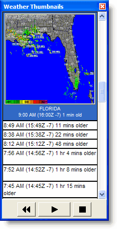
Use the animation portion of the Weather Thumbnails dialog box (Weather > Weather Thumbnails) to animate weather in the Weather tab. When you have more than one version of an image, the chart animation buttons below the thumbnails become active. Animation works with two images, but having several images provides better trend information.
· Click
the Forward arrow ![]() to start animation.
to start animation.
· Click
the Stop button ![]() to stop animation.
to stop animation.
· Click
the Back arrow ![]() to show the animation
in reverse.
to show the animation
in reverse.
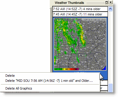
Deleting a weather image in the Thumbnails pane removes the file from your computer. To delete weather images, use the Weather Thumbnails pane:
To delete a single weather image, right-click the image and choose Delete.
To delete a series of the same weather map type, right-click the image and choose Delete [image label] and Older.
To delete all the images, right-click any weather image and choose Delete All Graphics.
See also: